NorCal LED Weather Map
$650 including taxes. Pick-up at Palo Alto airport (free) or shipping via UPS (prices vary).
20% off for Advantage Aviation members! Just enter the WiFi password (in all caps) as the discount code at checkout to get 20% off the price.
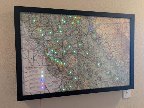
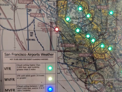
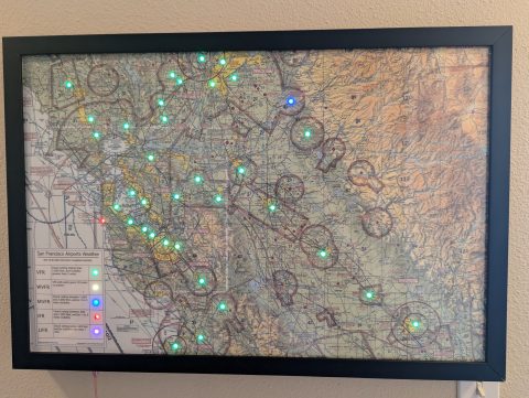
This smart map uses your WiFi internet connection to get real-time weather¹ updates for 30 airports in the San Francisco area, stretching from Santa Rosa in the north to Monterey in the South. The weather information is collected from NOAA’s Aviation Weather website, the most trusted source for accurate weather information for the aviation community². See the impact of weather systems as they roll across the landscape. At a glance visibility of where might be a good place to fly today for that $100 hamburger².
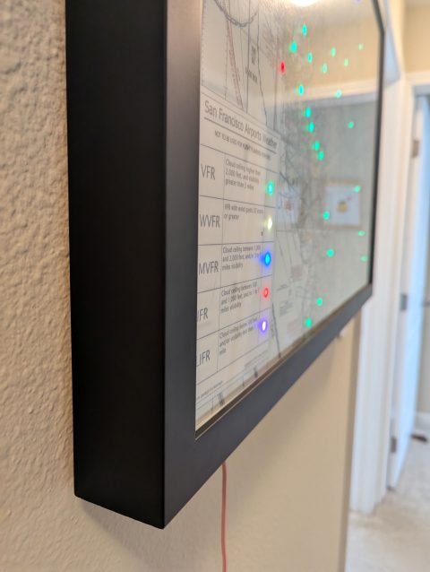
Carefully crafted using high-quality printed foamboard with 12mm RGB LEDs poking through specific airports¹, with a USB-C socket for 5V DC power (10A power supply included).
Easy to set up and requires no ongoing maintenance. Makes an interesting addition to the wall in your office or study, or the perfect gift to show your appreciation for the pilot in your life.
Specifications:
- Size: 20 inches (tall) by 30 inches (wide) and 2 inches (depth)
- Power: 5-volt DC USB-C power cable (included)
- Connectivity: Map is connected to weather information via WiFi. WiFi must have internet access (no proxies).
- Setup: On first run, the map will show up on WiFi and present a settings page, allowing the selection of the preferred WiFi network.
12 months of updates and support included. Updates after 12 months made available with instructions via email/ website.
Notes:
- Although the weather data is being collected from an authoritative source, and every effort has been made to ensure the accuracy of the data, the LED Wx Map should not be used as the only or primary weather briefing tool for aviation. It is helpful to gain a high-level perspective of current weather across the region but must be backed up with weather briefings and analysis for your planned route of flight and any alternates.
- The map is programmed to get weather updates every 5 minutes. The weather information is taken from current METARs for select airports where Aviation Weather makes this data available. Weather data is only updated by the airport and Aviation Weather every hour. If the weather is rapidly changing the airport might more frequently make weather updates; updating the map every 5 minutes is a good balance of timeliness without unnecessary use of the WiFi. Future changes in the Aviation Weather API or the METAR data being provided by the airport might mean that weather data for an airport is no longer available. When the data isn’t available the LED for that airport will remain dark. Where possible, software updates with instructions will be made available to correct the function.